ARBUSCULES & CONSTELLATIONS

Arbuscules & Constellations


Reproductions of pen-and-ink drawings of arbuscules, part of an ongoing series.


Detail of cadavre exquise drawing


Detail of cadavre exquise drawing


Detail of cadavre exquise drawing

Zone2Source, Amsterdam

Film screening, installation, residency

I spent a few weeks in June and July 2023 in Amsterdam's Amstelpark holding drawing, talking and walking sessions with artists, art educators, performers, and scientists from the Toby Kiers and Vasilis Kokkoris Labs, Amsterdam Institute for Life and Environment (A-LIFE), Vrije Universiteit (VU) Amsterdam. 

We discussed issues around cross-disciplinary projects, drilling down into fundamental questions at the heart of what we do – what drives us, what drives us nuts, and how do arbuscular mycorrhizal fungi work?

A long drawing evolved along the lines of a Surrealist cadavre exquis (or a game of Consequences). Our collective exquisite corpse was unrolled on 18 July in Zone2Source's Orangerie Park Studio.

I presented a montage of oak-gall ink drawings and aerial photos of virgin rainforest reproduced as textile prints, and part of an ongoing series of pen-and-ink drawings of arbuscules. Arbuscules are tree-like structures that arbuscular mycorrhizal fungi grow inside pant cells. Very hard to image, they're vital sites of nutrient exchange between plant and fungi.

My film This Entangled Land was screened in the Zone2Source exhibition space, Het Glazenhuis, and under trees near the Orangerie, Amstelpark.

THIS ENTANGLED LAND

Film THIS ENTANGLED LAND

This Entangled Land

My film This Entangled Land (24', 2022) has been screened at RADIUS Center for Art and Ecology (Delft), Zone2Source (Amsterdam), and under the trees in Amstelpark, near the Zone2Source Park Studio, Amsterdam.

This Entangled Land was an award winner at the Mannheim Art & Film Festival 2022. 

I released fungi-related sections of This Entangled Land (shown here) to mark the launch of SPUN - Society for the Protection go Underground Networks. The film features an interview with Toby Kiers, Executive Director & Chief Scientist at SPUN - Society for the Protection of Underground Networks and Professor of Evolutionary Biology and University Research Chair at Vrije Universiteit Amsterdam. I've been working with research into arbuscular mycorrhizal fungi and plant-fungal interactions from Toby Kiers' Lab at Vrije Universiteit (VU) Amsterdam for more than a decade. My film This Entangled Land is a visual and sonic tapestry of social, biological and cultural interactions. Its narratives weave their way along a logging road in Borneo, branch off into villages and languages, zoom in on fungal networks in the soil and zoom out to view their global impact.

The screening at RADIUS Delft was accompanied by a lecture by Toby Kiers on mycorrhizal fungi and the work of SPUN. The screening at Zone2Source was accompanied by a lecture by Malin Klein on mycorrhizal fungi and their interactions with plants in the soil. She showed some of the latest research and images from the Kiers and Kokkoris Labs (VU Amsterdam) and SPUN. Malin is a PhD candidate in the Toby Kiers Lab at the Amsterdam Institute for Life and Environment (A-LIFE), Vrije Universiteit (VU) Amsterdam where she was previously a research technician.

COLLAGES

Money Doesn't Grow on Trees... (2020), cut-out, silk-screen prints of trees extracted from various banknotes and currencies, 38cm x 102cm.


Impossible Currency Range 2 (2020), cut-out, silk-screen prints of mountains extracted from various banknotes and currencies, 14cm x 14cm.


Impossible Currency Range 6 (2020), cut-out, silk-screen prints of mountains extracted from various banknotes and currencies, 14cm x 14cm.


Impossible Currency Range 5 (2020), cut-out, silk-screen prints of mountains extracted from various banknotes and currencies, 20cm x 20cm.


Impossible Currency Range 4 (2020), cut-out, silk-screen prints of mountains extracted from various banknotes and currencies, 14cm x 14cm.


Impossible Currency Range 3 (2020), cut-out, silk-screen prints of mountains extracted from various banknotes and currencies, 18cm x 24cm.


Impossible Currency Range 7 (2020), cut-out, silk-screen prints of mountains extracted from various banknotes and currencies, 18cm x 24cm.


COLLAGES

DURN THAT ROAD

Durn that Road - Bradwolff Projects Amsterdam


From top: Logging in Sarawak (R.I.L. Howland 1963); cargo distribution diagram (cross-section) (R.I.L. Howland 1964); Cargo Notes (1962).


Pages from Dr Beatrice Clayre's Sa'ban-Malay-English picture dictionary; video of interview "Last Time" - Before the Road.  ©2019


ESSAY

Mark That Maps Itself: On Roads That Lead Nowhere

by Alena Alexandrova, based on her lecture about Annabel’s work and this exhibition in particular.


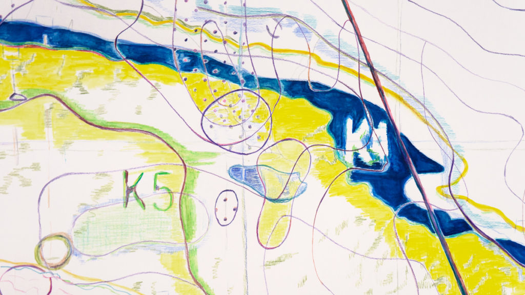
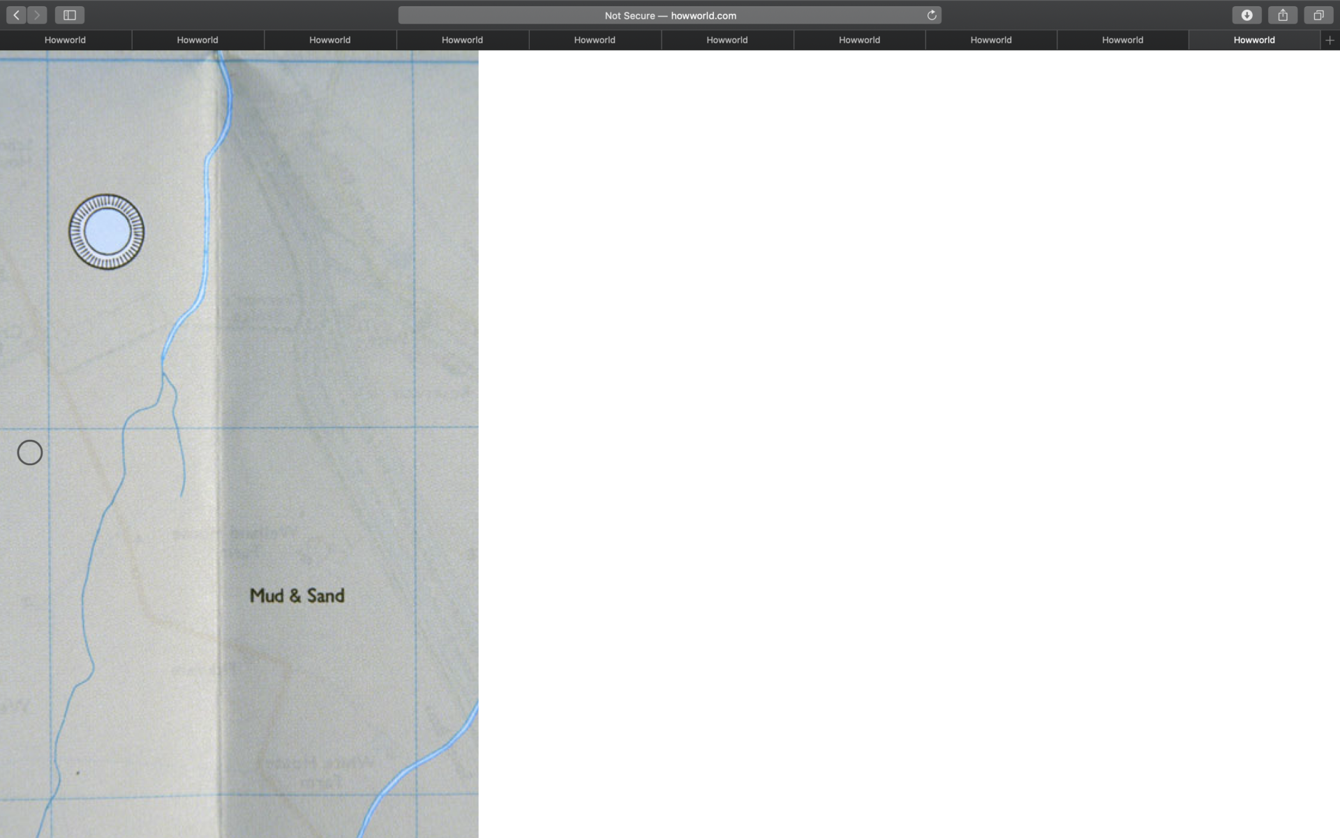
ROAD – associated with horizontality, expansive, causes flattening.

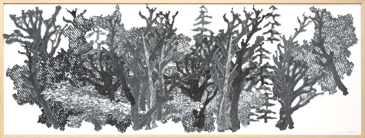
FOREST – a living network, vertical, and thick, creates its own climate.

TREE TRUNK – its rings are a record of time, circular and layered, they become visible only when the tree is cut, at the moment of its death.

FALLING – the change between vertical and horizontal states associated with becoming dead and motionless, but also with becoming transportable.

STACKING – the piling up of different materials and commodities, which previously belonged to different contexts, in order to store and transport them. This results in a strange form of flattening. Flattening is an entropic process.

FLOWING – mobility, resistance to containment, but also relating to leaking and flooding.

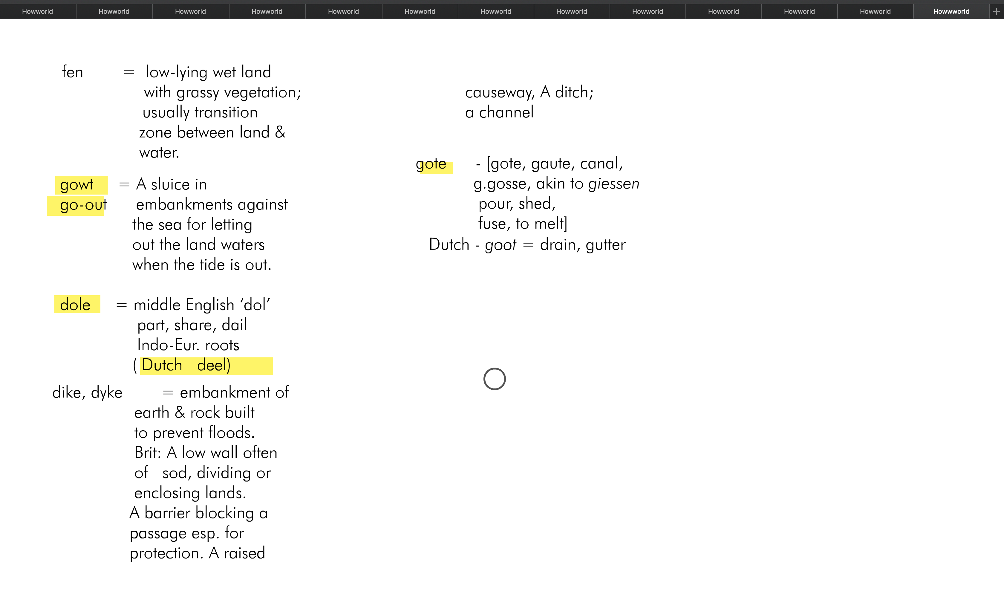
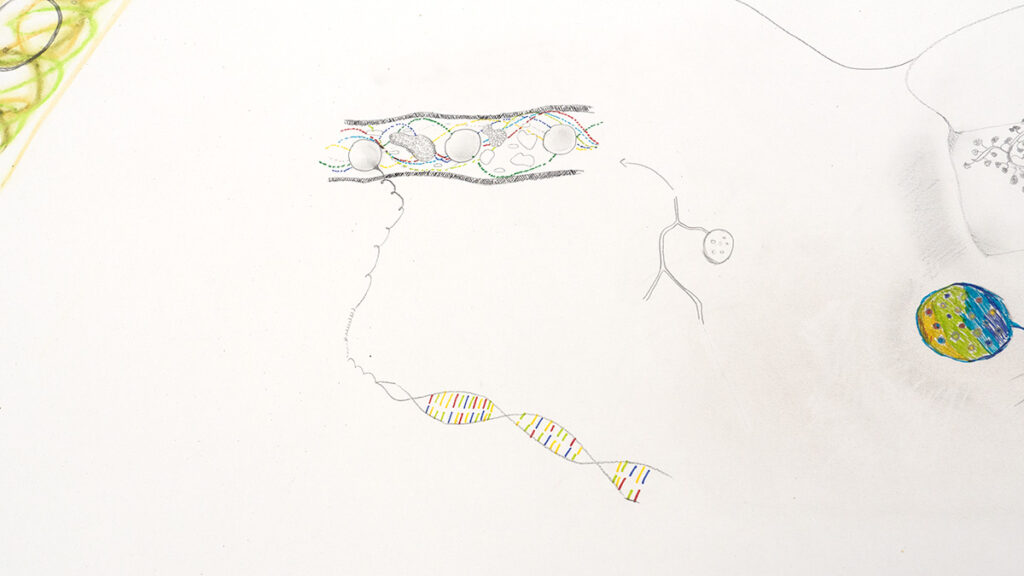
WORDS – can be seen as flat, and flattening, insofar as they come with the building of roads. Can be seen as vertical, insofar as they capture the complexity of local habitats.

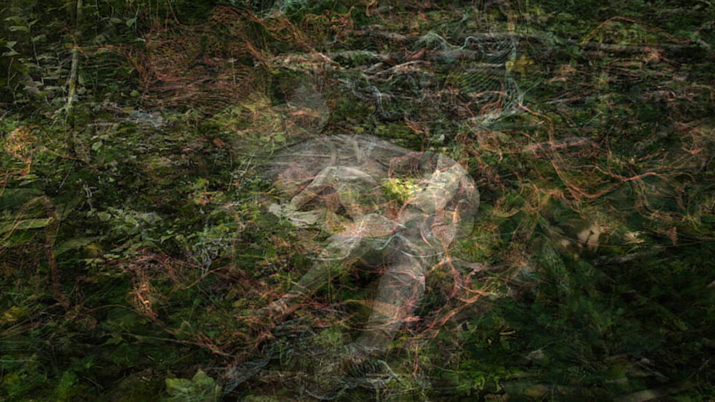
FOLIAGE – immersive environment, impenetrable surface to blend with and disappear.

VERTICALS – generally static, articulating long, deep time, associated with life.

HORIZONTALS – generally mobile, articulating fast time, associated with death, flattening.

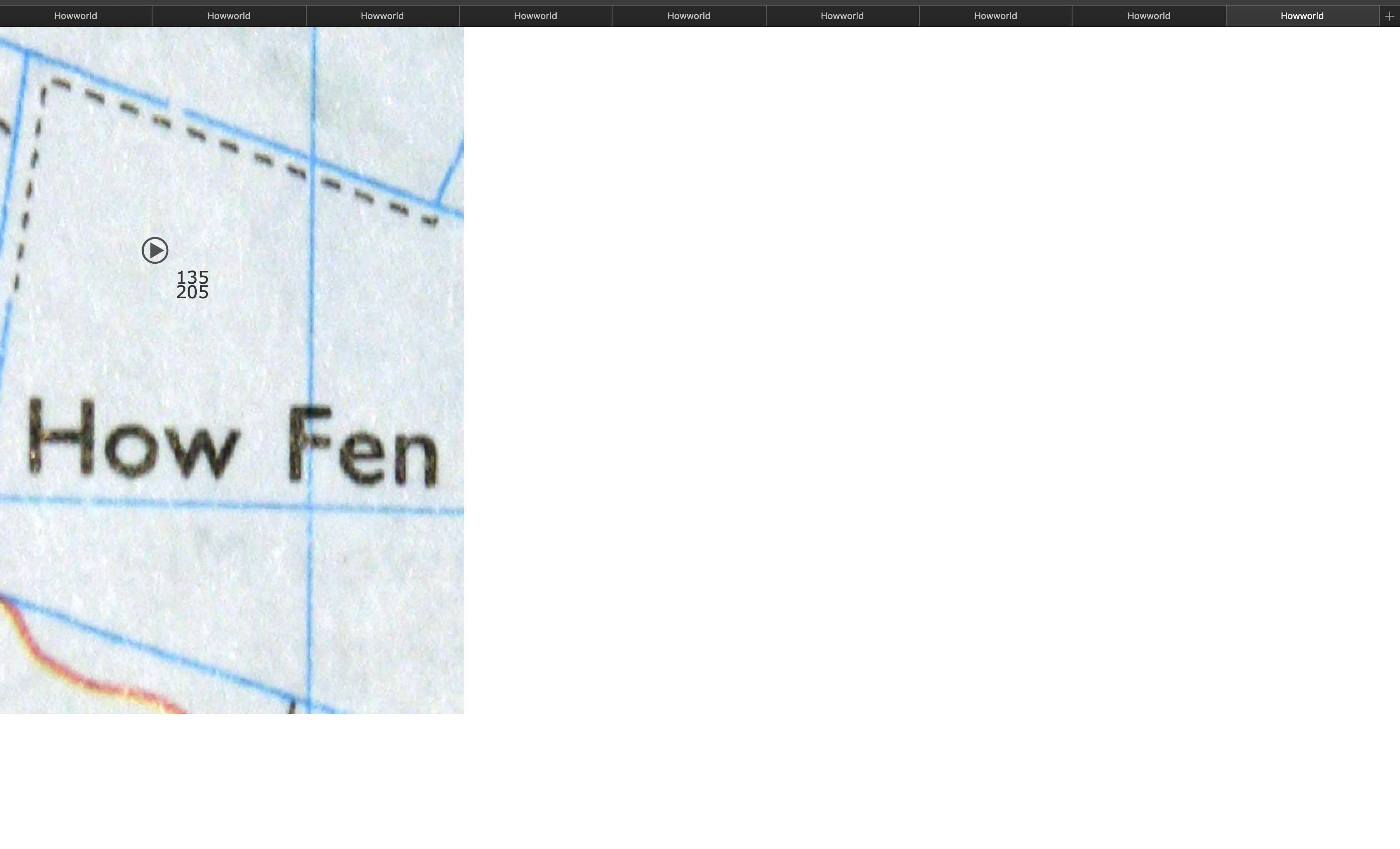
ROOTS and root-like structures – should never become visible, or brought to the surface. When they do become visible, they form a network of marks that can signify stasis and death.

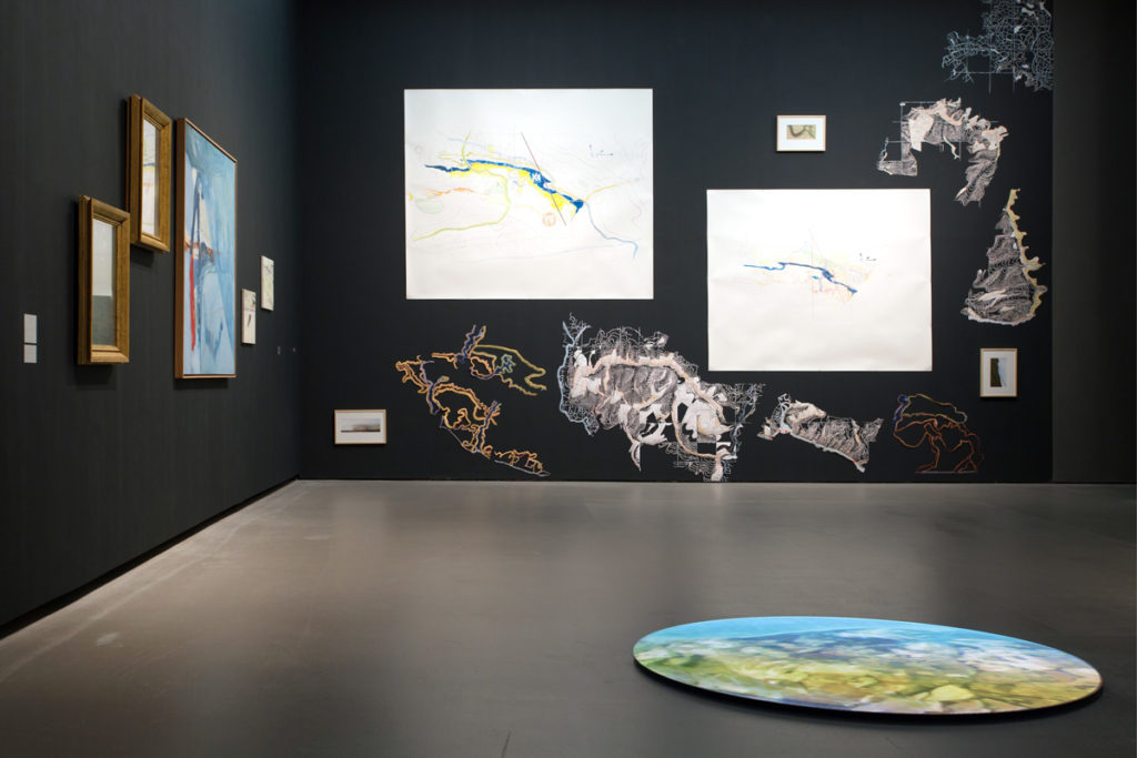
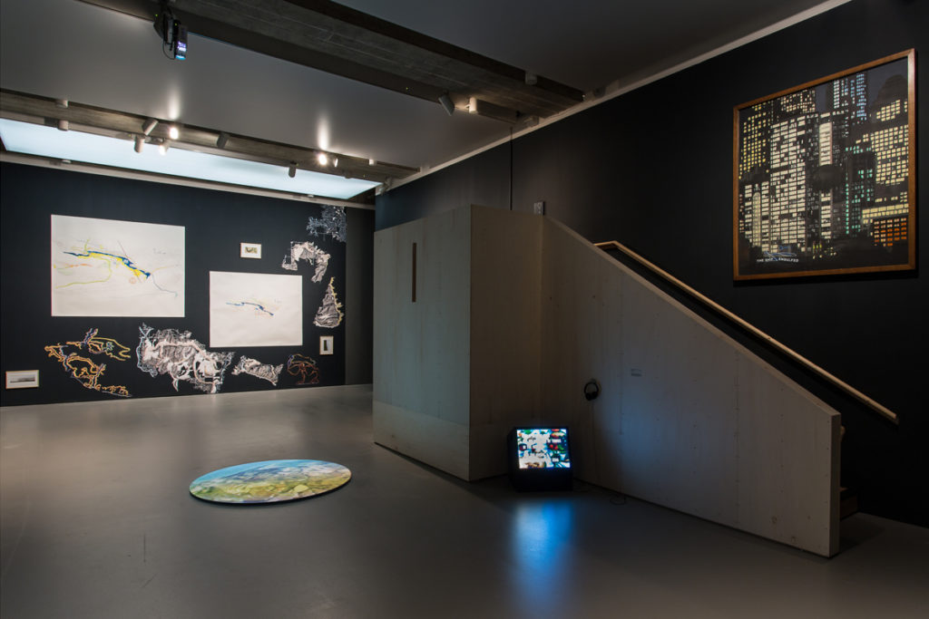
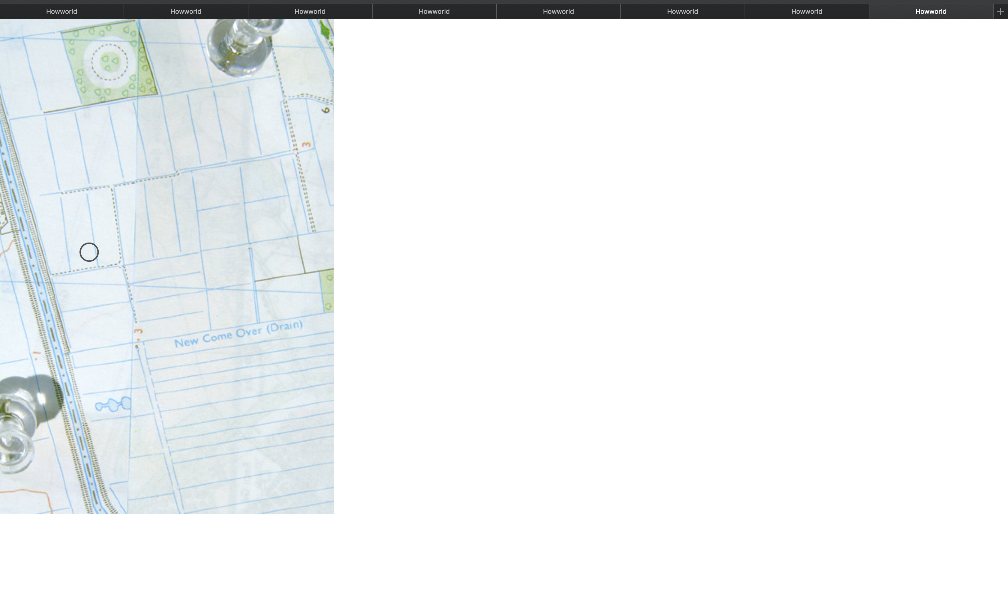
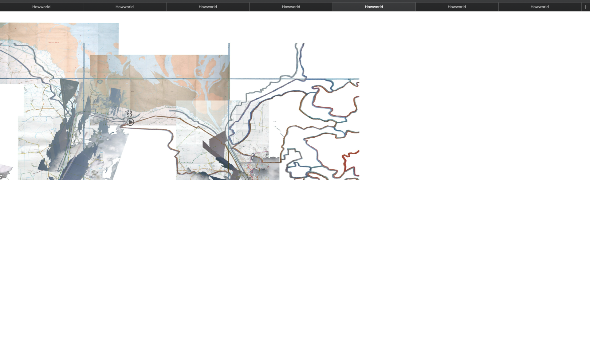
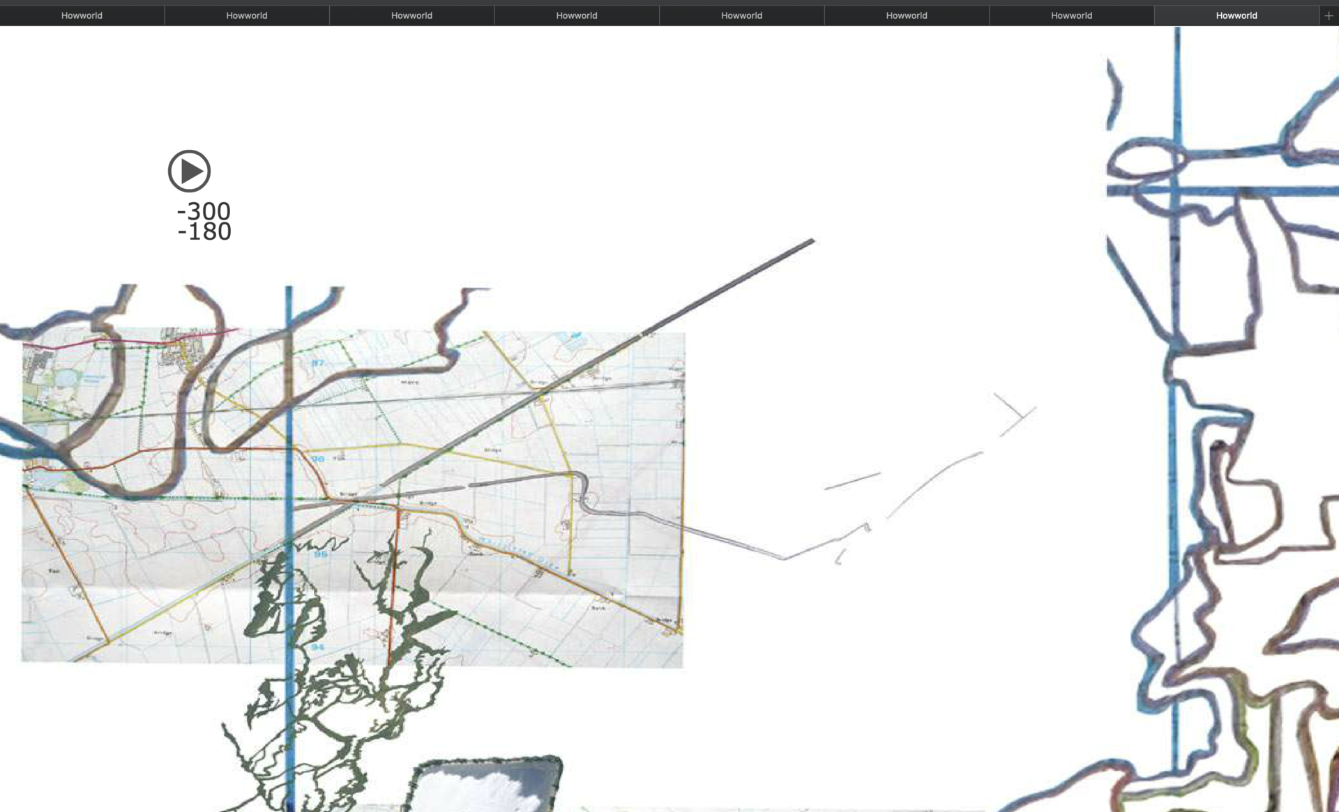
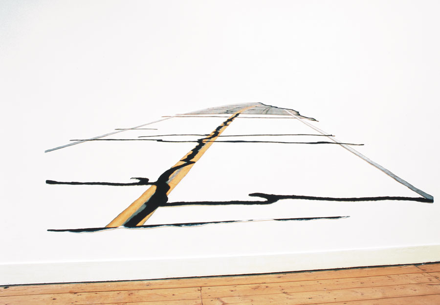
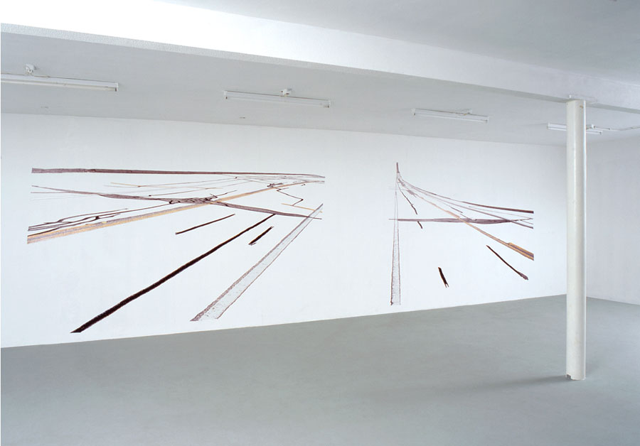
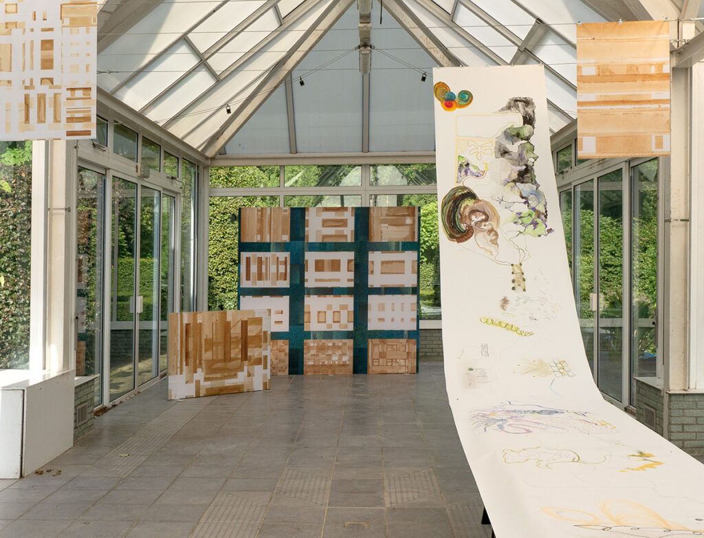
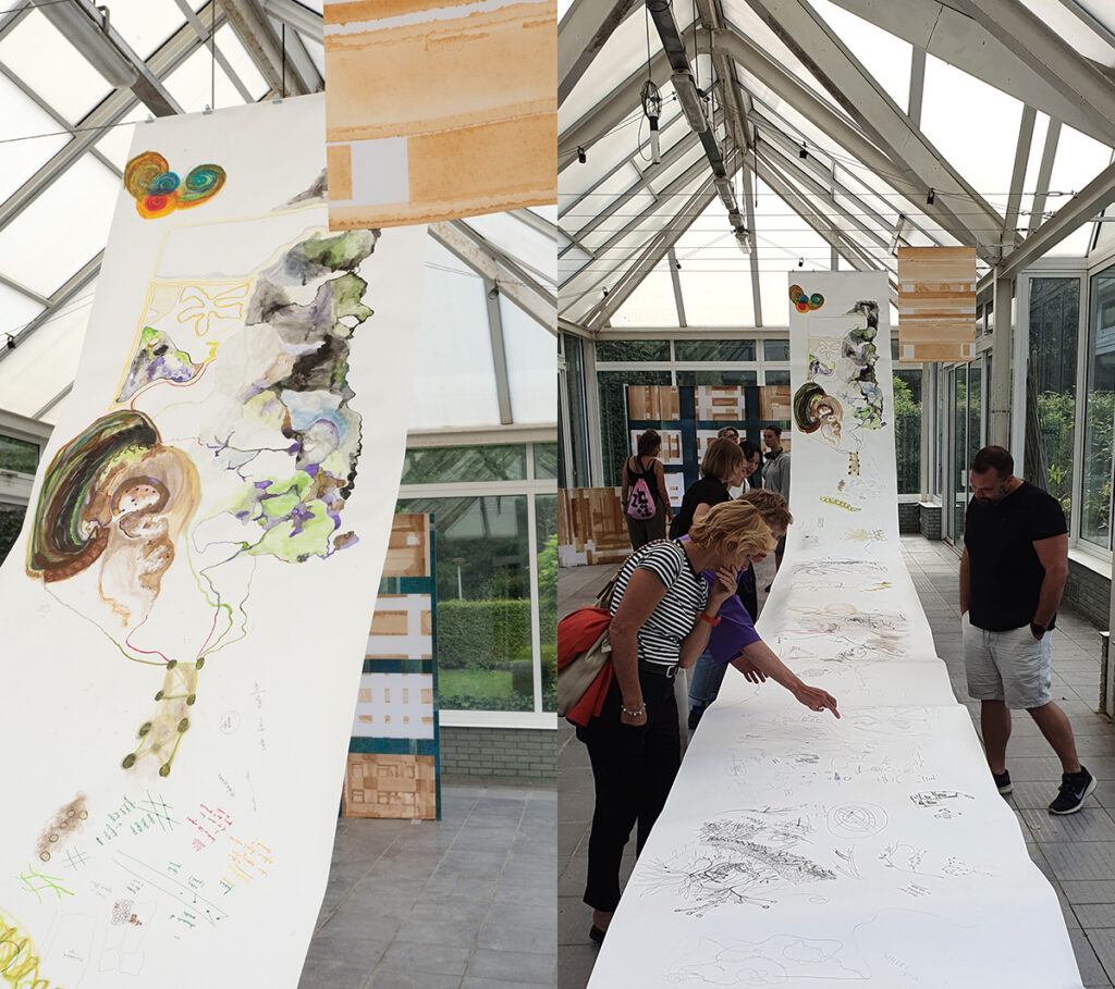
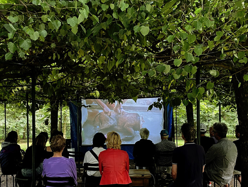
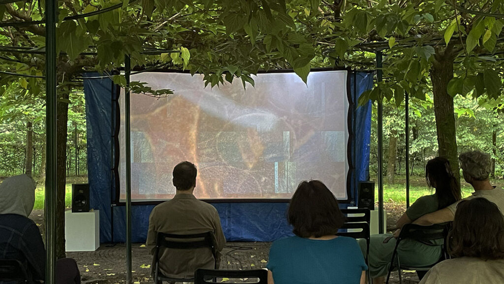
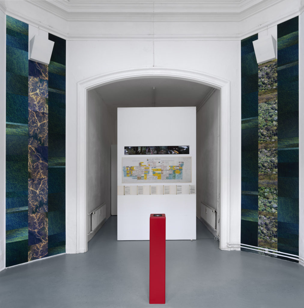
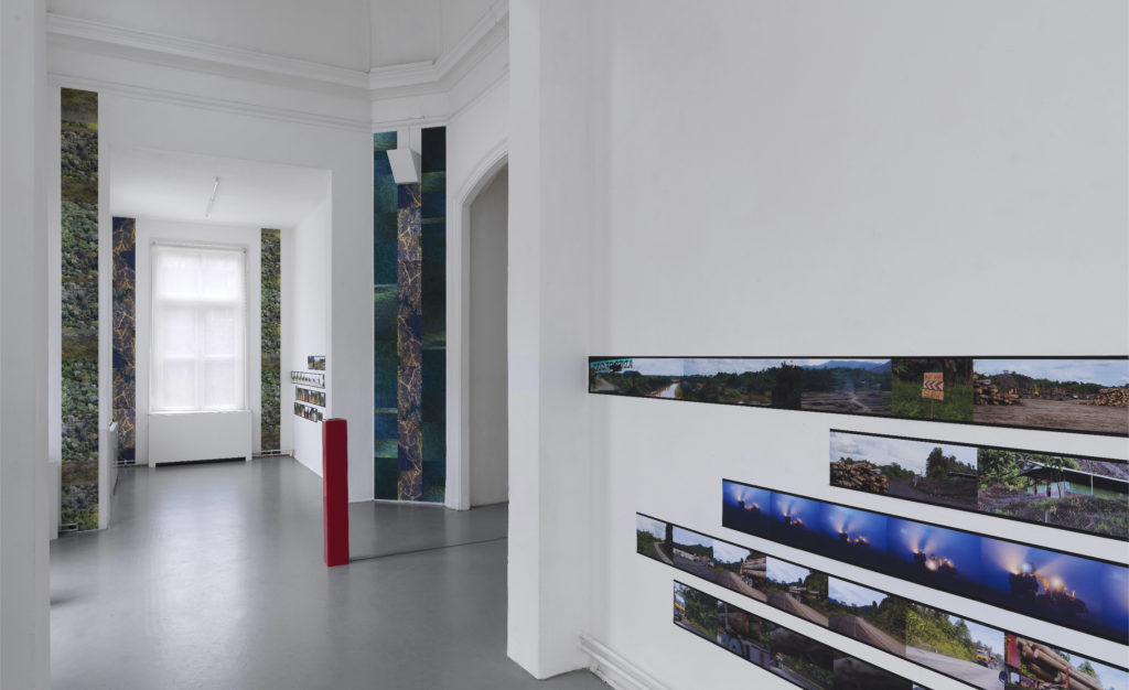
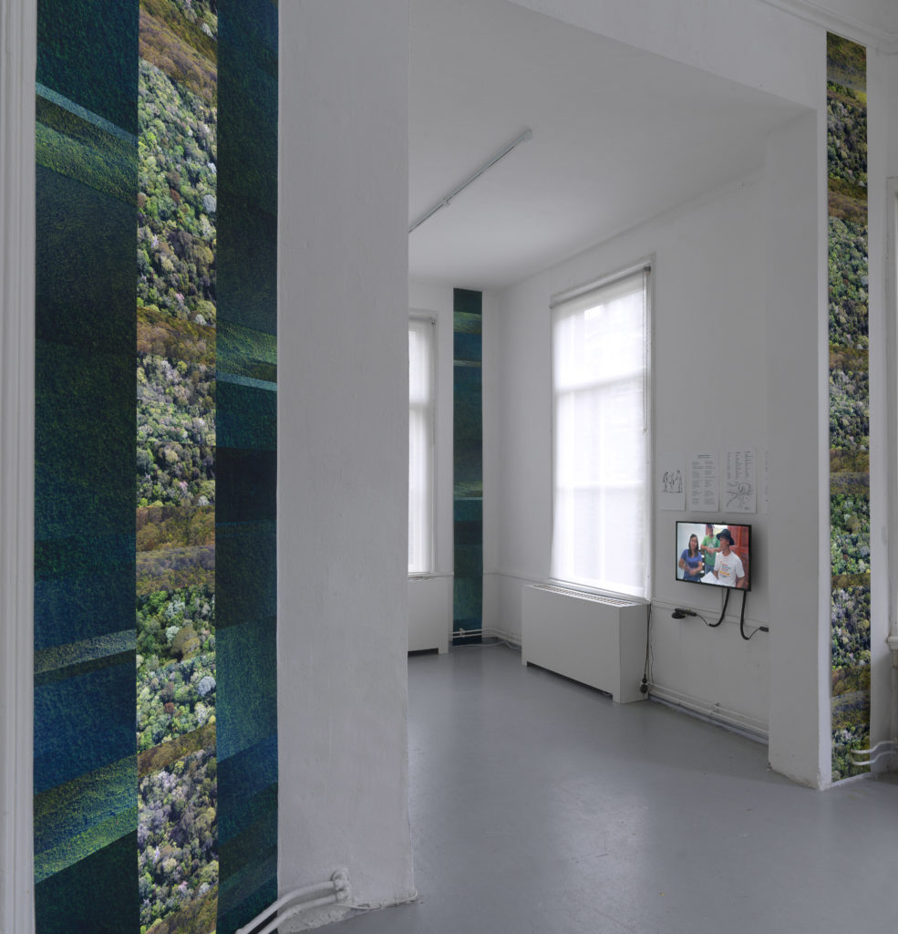
Durn That Road (2019) by Annabel Howland is a work that witnesses a journey to an island and its people, gestures, words, animals and plants. The installation consists of material collected on journeys to Borneo. A constellation of vertically and horizontally organized photos and film stills, field recordings, an interview and documentary excerpts together compose an installation that outlines the invisible flows of capital that determine the visible devastation of a landscape.

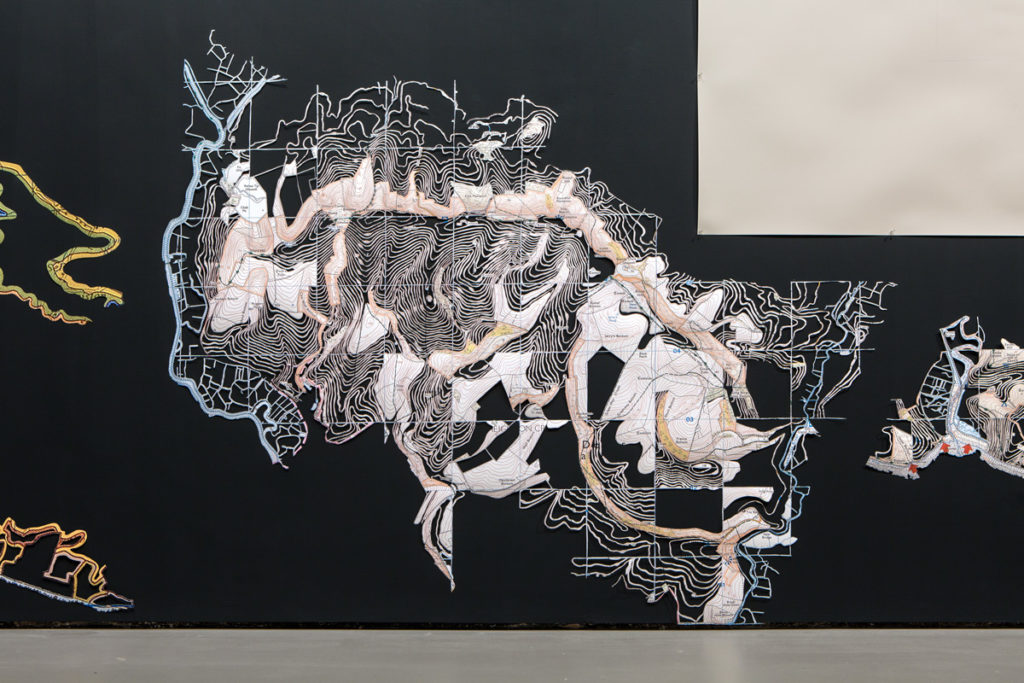
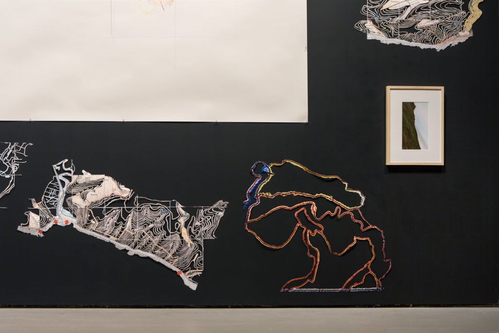
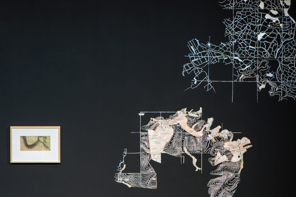
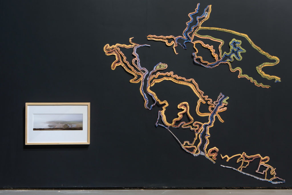
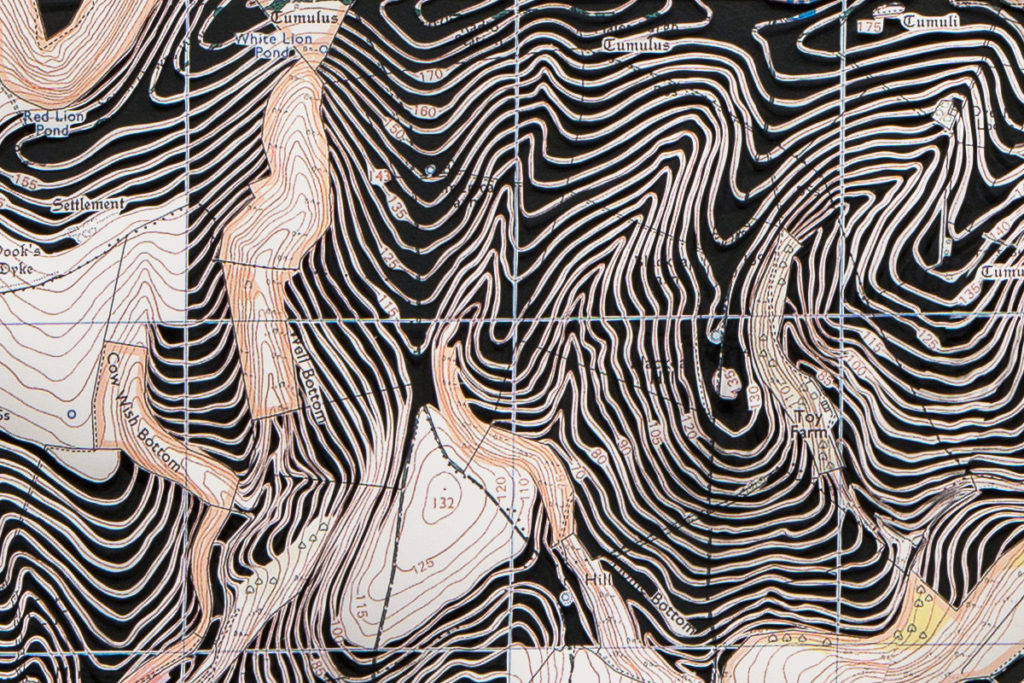
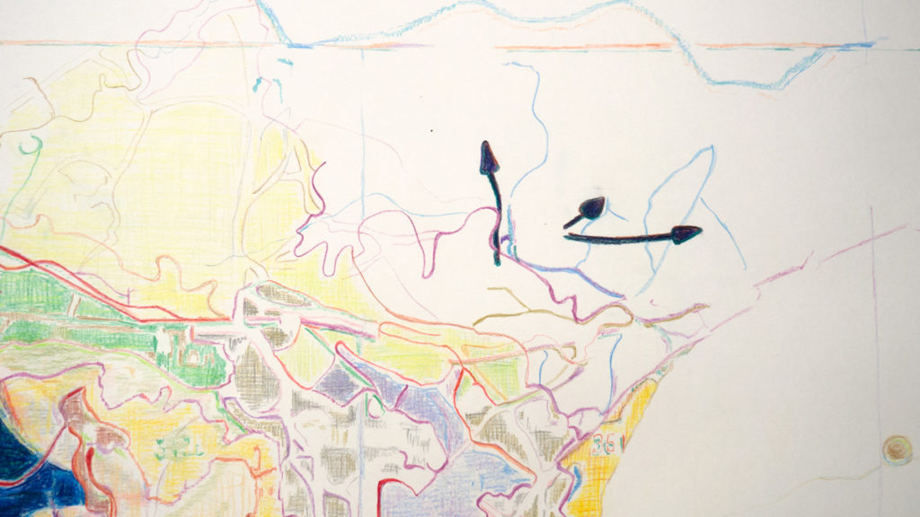
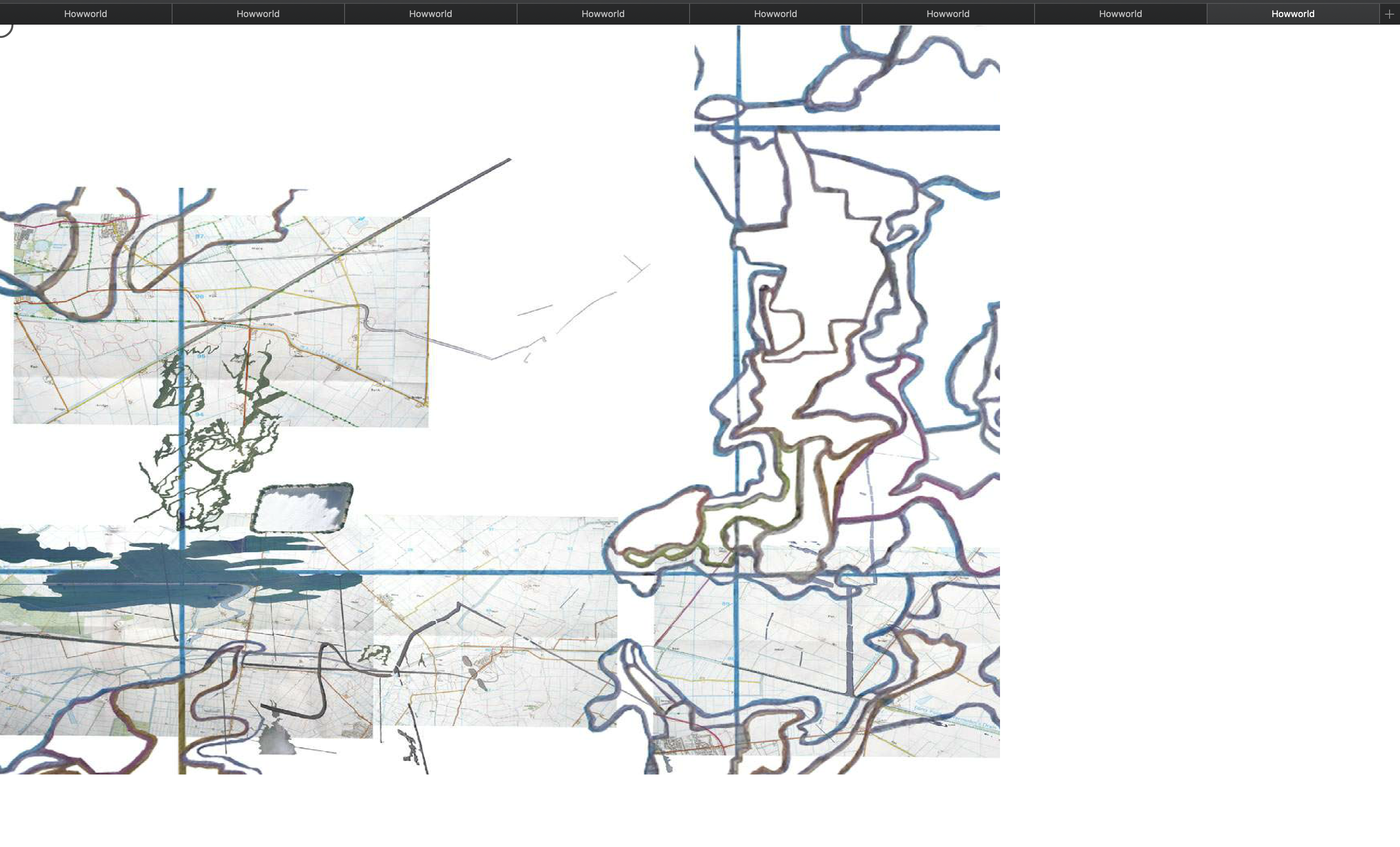
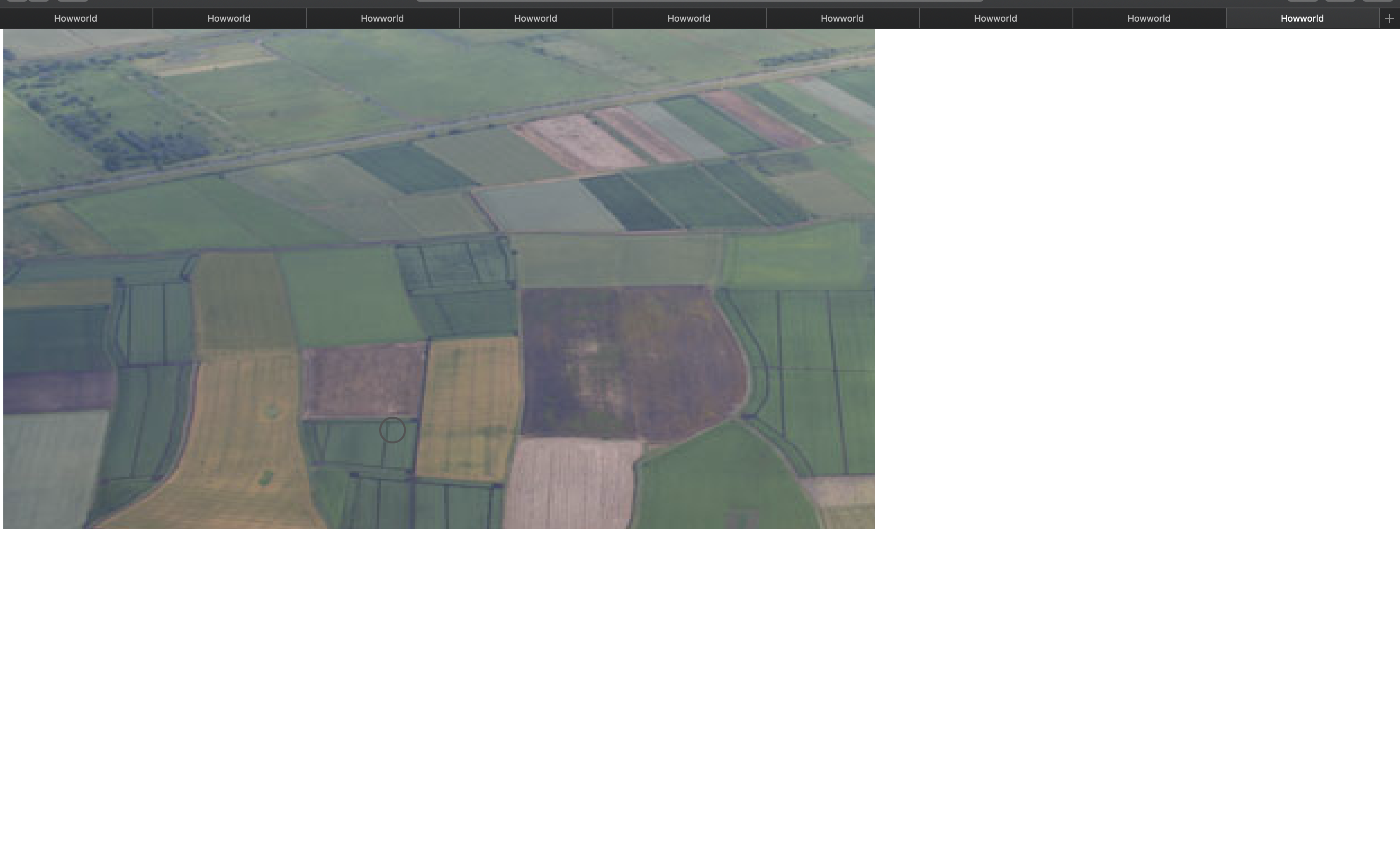
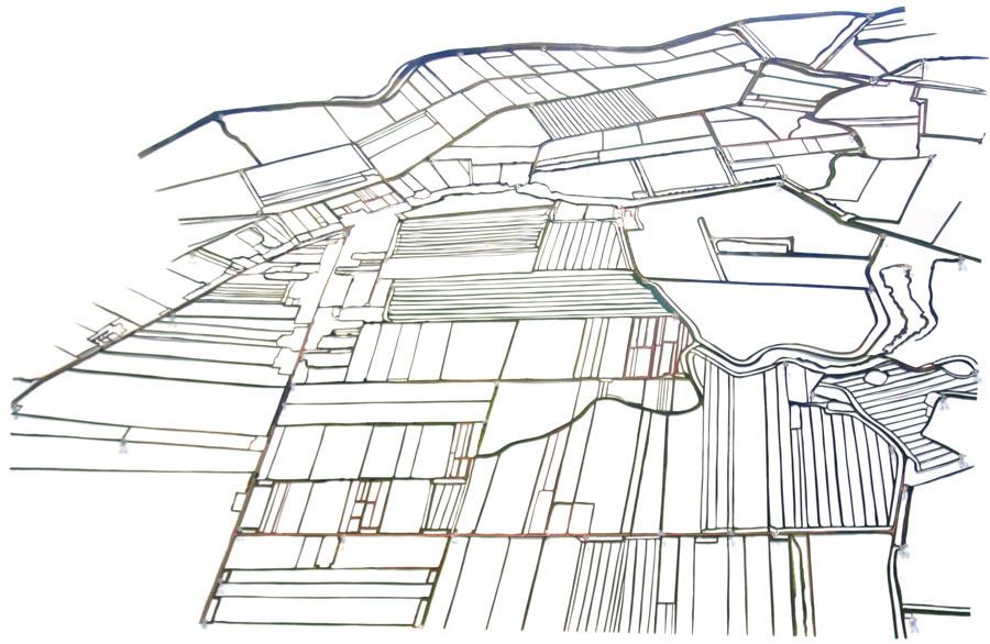
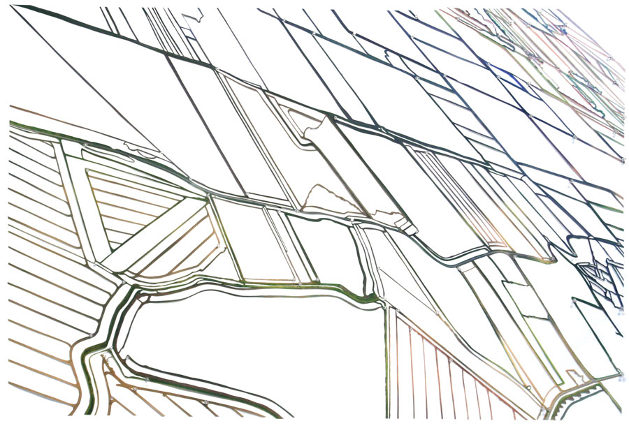
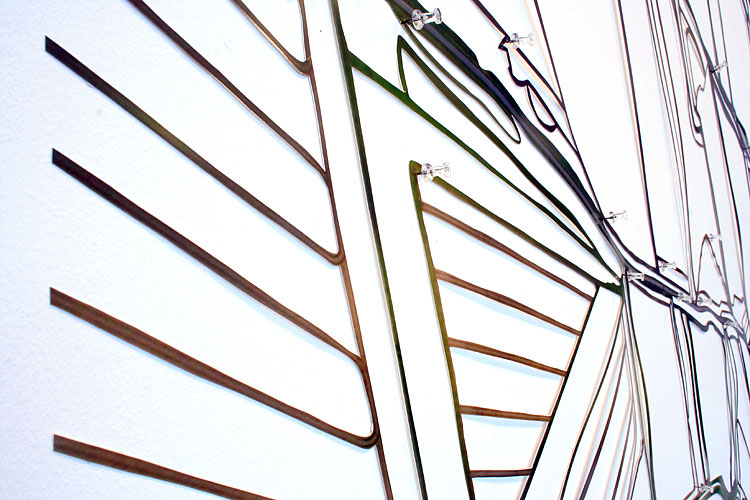
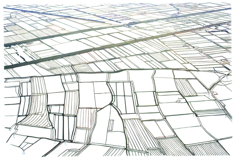
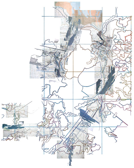
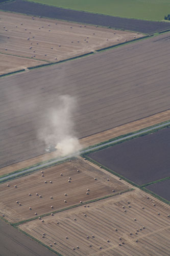
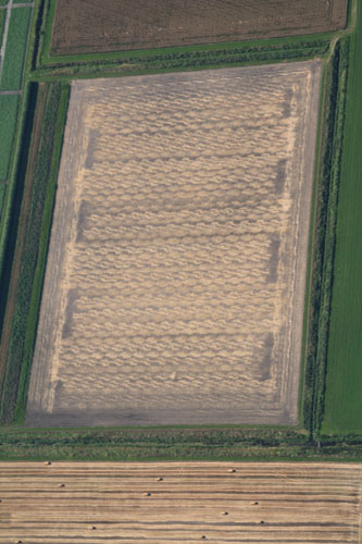
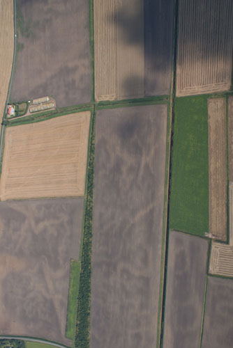
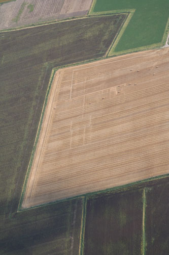
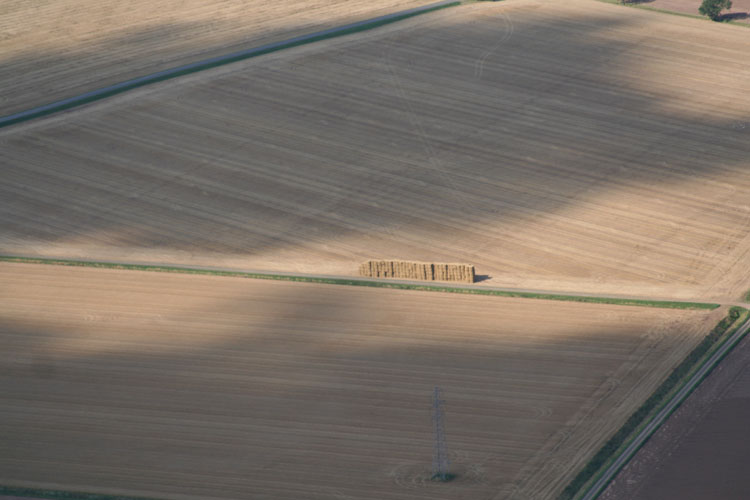
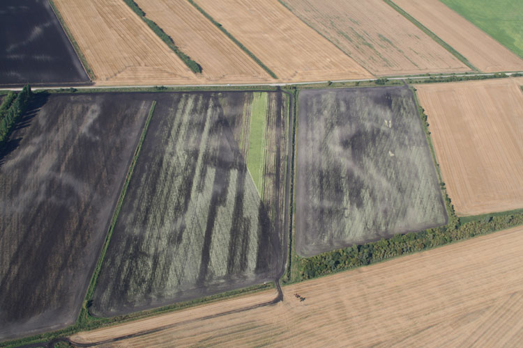
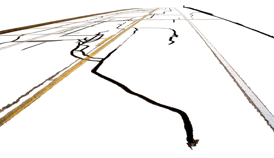
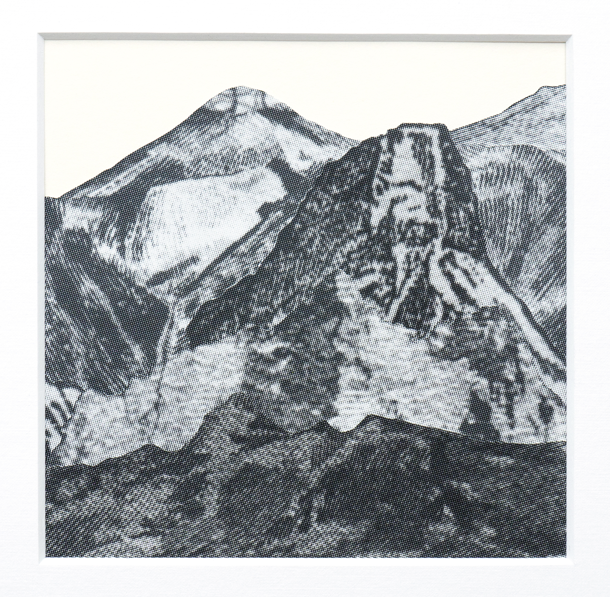
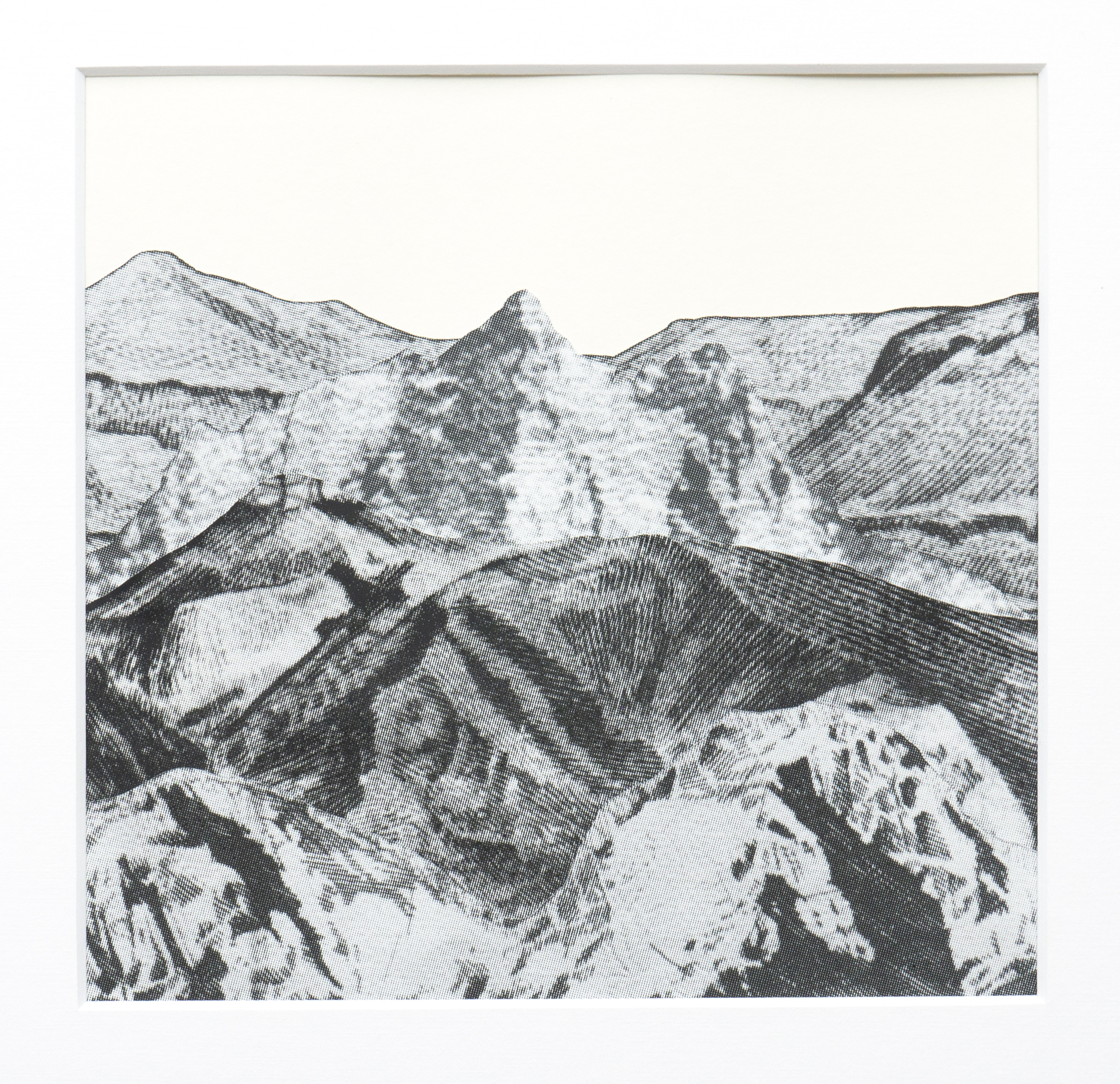
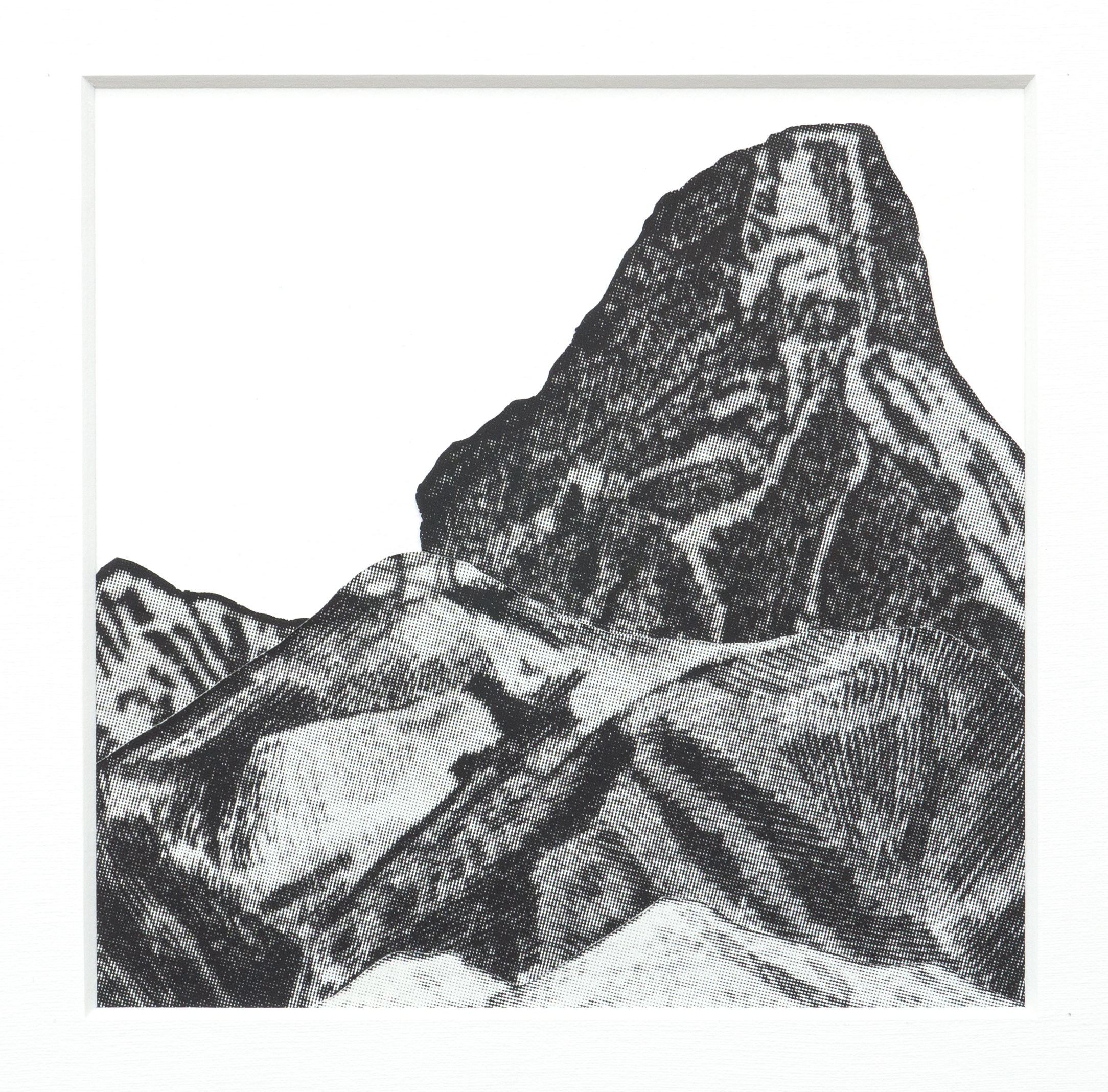
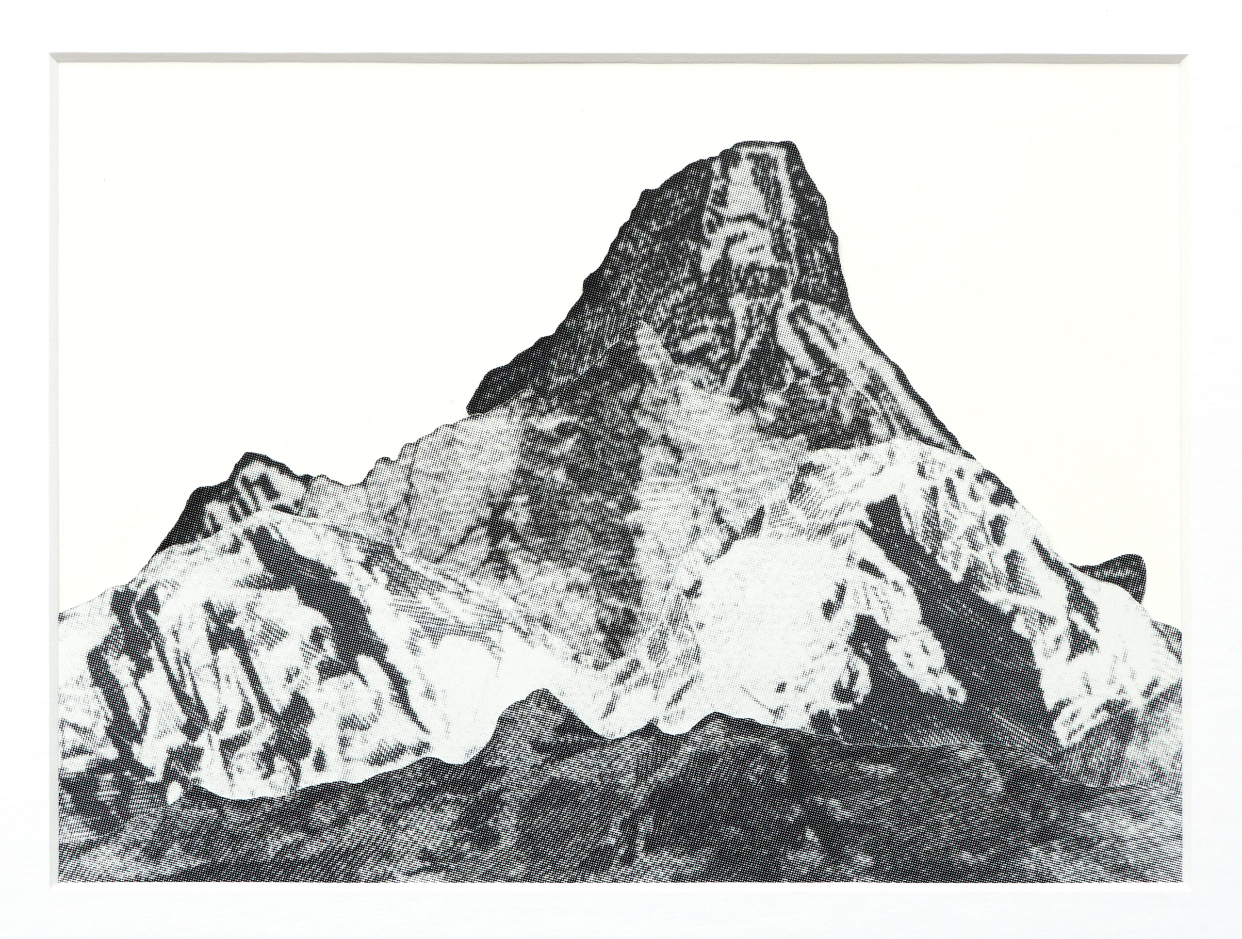
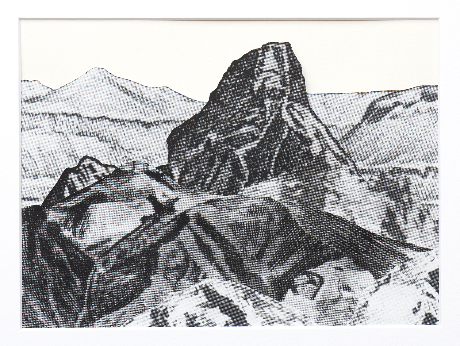
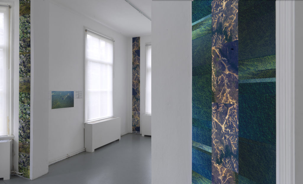
Durn That Road does not narrate, it is not exactly a travelogue, nor is it a field study. It articulates the visibility of the complex forces that determine an unfolding ecological disaster in a grid-like structure composed of horizontal and vertical planes. The verticals are formed by a constellation of aerial views showing expansive networks of roads that penetrate the land, but lead nowhere. The logging sites and roads form a strange flat, root-like structure that grips the land, transforming it into a barren, surveyable territory. The vertical collages also show aerial views of the forest as a thick surface of tree crowns; a deep green, soft pattern. They suggest the structure of sedimentation, or geological layers that form in deep time and resonate with the living time of one of the oldest rainforests on the planet.

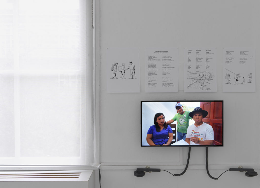
The installation includes field recordings of the sounds of the forest and their modulation through the process of deforestation. The ambient sound of the forest changes in texture depending on where the logging sites are, so one can literally hear the flattening in the texture of sounds. The voice of children reading a dictionary of a local language Sa’ban, resonates with the sounds of a land gradually losing its voice with the destruction of its forests. In a filmed interview shown on a screen, three Sa’ban people discuss how the new road connecting their village to the city is changing communal living and their relationship to money. The interview captures a similar process of flattening, or erosion, that affects the delicate social networks of extended families and their everyday lives. The semi-nomadic use of land by family groups gradually transforms into a more settled use of the land, often nearer the road. Roads improve access to education and paid work, but also to building materials, leading to a dilution of social relations as families begin to live in individual houses instead of communal longhouses. Game hunted in the forest can now be sold, instead of shared with the community. The horizontal penetration of the land for the use of its resources causes its social textures to fragment and flatten, and perhaps, over time, brings about the gradual loss of complexity in its local languages.

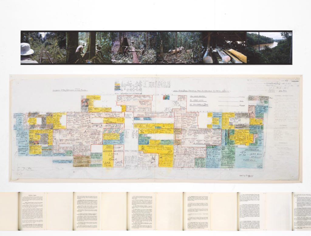
An enlarged bulk cargo distribution diagram and pages from a ‘cargo notes’ instruction manual from 1964 describe how raw materials from across southeast Asia – timber, latex, apricot kernels, frozen rabbits, chicken eggs, and many other commodities – were to be stowed in ships’ holds for export to Europe. Composed of verticals and horizontals, the diagram and notes articulate a language of capture, of translation of the land into goods and materials, and point to the shallow, accelerated time of trade, the export of materials, and to financial flows. Horizontals and verticals form the generic infrastructure of grids, and grids establish an abstract, homogeneous flatness that is very different from the folds and crevices of a space understood as an environment or a habitat. Living trees become horizontal logs. Verticals converted into horizontals mark a loss of complexity; a transformation of complex, dense planes of a habitat into surveyable surfaces and, hence, death.

Horizontals and verticals relate to different types of visibility and embodied experiences. Being in the forest, in an environment composed of vertical trees, implies a relation of immersion. In contrast, a view from above captures the land as a horizontal, observable, mappable surface. This cartographic view establishes a territory as an abstract plane, it “abstracts” it into a virtual model, an informative capture of a territory with its network of roads. But in Durn That Road the photo collage of aerial views of the networked marks of the logging roads are not a representation of the roads on the island; they are very concrete and in a sense tautological; they are roads with no other function than the extraction of resources, and they signify nothing other than their own presence. They chart a map of disaster, not a place; they are a mark of destructive and invisible flows of financial capital and corruption.

The composition of vertical and horizontal planes resonates with the rhythm of two temporal perspectives, more precisely with their clash: the accelerated time of extraction and destruction and the deep time of one of the oldest rainforests on earth. This marks a crisis of human self-understanding under the conditions of technological modernity, which brings acceleration and complexity, but is also an entropic process of flattening. Durn That Road does not exactly produce a documentary or investigative report. Rather, it creates an open fragment that witnesses different aspects of forces that simultaneously build and ruin. And it witnesses the accelerated rhythm of resource extraction, which results in a future that fails before it is reached. Howland’s practice observes and articulates the visibility of speculative interactions between a range of complex systems which, though not usually visible, are always omnipresent.

Alena Alexandrova, Amsterdam 2019


PRESS RELEASE

Durn That Road

Sunday 20th January to 17th February 2019

Annabel Howland’s artworks weave speculative webs around ecology, finance and art. Looking through the lenses of different fields of research, she unpicks, isolates and reweaves threads from these systems. The resulting installations constantly shift between scales and perspectives in attempts to fathom and imagine the systems’ complex twists.

The title, Durn That Road, quotes the character Anse Bundren in William Faulkner’s 1930 novel As I Lay Dying. Anse is introduced to us through his rant against a road he finds threatening, mainly because it brings people (i.e. the taxman) to his door, but also because of its implicit demand for movement. “When He aims for something to be always a moving, He makes it longways, like a road or a horse or a wagon, but when He aims for something to stay put, He makes it up and down ways, like a tree or a man.”

For her exhibition at Bradwolff Projects, Annabel has developed a multimedia installation, which takes as its point of departure a road through the rainforest in the state of Sarawak on Borneo (East Malaysia). This logging road started on the coast and was gradually extended through to villages near the border with Indonesia where Sa'ban is spoken. Dr Beatrice Clayre began studying Sa'ban in the 1960s. In 2013 she published a trilingual Malay-Sa’ban-English picture dictionary, by which time the changes to village life brought about by the road had become tangible.  In 2016, Annabel travelled the length of the road with Dr Clayre’s son, anthropologist Alasdair Clayre, and Semion Balan and Gareth Lihan from Long Banga,  filming and interviewing people about the road, their languages and their ways of life.

They started with simple questions about how the arrival of a road affects the people living along it, and how a minority language fares under the changes a road brings. But a line through the rainforest that links communities, which used to be separated by many days travel on foot or by boat, also links into other lines that criss-cross the globe, following the long flow of capital, raw materials, and religion.

The installation is structured around strong verticals and horizontals, intermittently penetrated by single point perspective.

BOURNES, DEANS, BOTTOMS & BROWS

Bournes, Deans, Bottoms and Brows

Detail cut-out Bournes, Deans, Bottoms and Brows

Details, drawings, Bournes, Deans, Bottoms and Brows

AT ALTITUDE

with Omer Fast 5000 Feet is the Best

An Arts Council Collection National Partner Exhibition
2018, Towner Art Gallery, Eastbourne

At Altitude, Towner Art Gallery, Eastbourne

At Altitude is a selective look at the historical impact and the continuing appeal of the aerial image. Ranging from the exhilarating viewpoints of early aviation to the all-enveloping but flattening vantage point of Google Earth, the exhibition charts these changing perspectives, illustrating how the wonder of the overhead view was transformed through advances in technology as altitudes became higher and horizons more distant.

An illustration from Thomas Baldwin’s book Airopaidia (1786), “A Circular View from the Balloon at its greatest Elevation” sets the context for At Altitude. The drawing is considered to be one of the first ever ‘real’ aerial views, describing Baldwin’s one day in the air over Chester in 1785. The aerial potential of the local landscape, famously often depicted from an elevated position by Eric Ravilious, provides another source of inspiration. The exhibition then focuses on recent decades, looking at increasingly technological mediations of the landscape, the role of conflict in the elevated view, and how changing methods of observation have inspired and informed artists.

Bringing together works in film, video, photography, sculpture, painting, drawing and installation the exhibition features artists including Jananne Al–Ani, Michael Andrews, Ken Baird, Tacita Dean, Charles and Ray Eames, Simon Faithfull, Mishka Henner, Dan Holdsworth, Kabir Hussain, Peter Lanyon, Christopher R. W. Nevinson, Cornelia Parker, Carol Rhodes and Wolfgang Tillmans, alongside a new installation created by Timothy Prus of the Archive of Modern Conflict and a site-specific commission for Towners Collection by Annabel Howland.


Bournes, Deans, Bottoms and Brows, Installation view, Annabel Howland, 2018
Photos by Rob Harris.

This work was generously co-funded by the Mondriaan Fund of the Netherlands.

HOWWORLD.COM

HOWWORLD.COM

A few screenshots from HOWWORLD.COM (Silicon Fen)


HOWWORLD.COM

HOWWORLD.COM was a work made in Flash for the web and was launched at the second iteration of the exhibition Drains, Cables, and Cuts at Ely in 2006. Drains, Cables, and Cuts was commissioned by Film and Video Umbrella and Norwich School of Art and Design, as part of Silicon Fen, a three-year programme of artists’ projects supported by Arts Council England East on the theme of landscape and technological innovation. This staging of Drains, Cables, and Cuts received additional support from the Mondriaan Foundation and the Fonds voor BKVB.

FEN CUTS

Gedney Drove End (2005) Cut-out, laminated, Lamda photo print 180cm x 120cm

Green Dyke (2005) Cut-out, laminated, Lamda photo print 180cm x 120cm

Green Dyke Detail © Alan Cook, 2006, courtesy FVU.

Hundred Foot Washes (2005) Cut-out, laminated, Lamda photo print 180cm x 120cm

Fen Cuts (Map) (2005) Photo- and cartographic montage.
Map for film Cut Drains, Charts, Creeks and Cuts

FEN CUTS

Drains, Cables, and Cuts is a photographic/video installation by Annabel Howland consisting of Howland’s signature cut-out images, a series of related landscape photographs and (a first for the artist) a digitally animated film.

Commissioned by Film and Video Umbrella and Norwich School of Art and Design, it is a work on the theme of landscape and technological innovation produced as part of Silicon Fen, a three-year programme of artists’ projects supported by Arts Council England East. This staging of Drains, Cables, and Cuts at King's Lynn Arts Centre, (14 January to 25 February, 2006) received additional support from the Mondriaan Foundation and the Fonds voor BKVB.

The focus of the project is the landscape of the East Anglian Fenland, rendered as a complex network of lines through the lens of a camera or a series of highly tactile cartographic abstractions. From the ground, the flatness of the Fens makes everything appear in relation to a vanishing point or an ever-present horizon line. From the air, however, this unique landscape reveals itself as an intricate, evocative space of overlapping lines and contours. The paths of old watercourses visible in the soil diverge from their contemporary counterparts or converge with other features, such as physical or administrative boundaries.

For her digital animation, Howland cut out aerial photographs of the Fens so that only watercourses, clouds and the shadows of clouds remain. These fragile images were then matched to their corresponding locations on a photographed map. The map had also been extensively edited so that only numbers remain and words and names that relate to water, light or measurements: Hundred Foot Washes and Twenty Foot Drain; Bridge, Dike, Lode and Leam; Gowt and Gote and Fifties and Forty; Marsh, Mere, Moor, Cut, River, Outfall. All this was further overlaid with brightly coloured contours derived from a soil chart of the area. These composite images were then animated into a 3D ‘fly-through’ along key Fenland waterways, down adjoining cuts and creeks, beginning and ending in The Wash.

Alongside this animation are two series of photographs. One, photographed from the ground, draws our attention to the lowness of the land, the line of the horizon marking the limit of what we can see or know. Stripped of the other features of the landscape, the intersecting lines (roads, tracks, railways, waterways, boundaries) in the large cut-out photographs come to occupy and define space almost architecturally. Oscillating between object and image, these works suggest an action that continues beyond their edges.

FEN PHOTOS

Blizzard Fen (2005) hand-printed colour photo 184cm x 230cm

Fenscope (Denver UK) (2005) framed, hand-printed, colour photo 74cm x 57cm

Fenscope(Stretham Mere) (2005) framed, hand-printed, colour photo 74cm x 57cm

Combine Cloud (2005), Woven Field (2005)

Roddons Highbridge Road (2005), Green Roddons (2005)

Roddons & Reservoir (2005), Stubble Plan (2005)

Fenstack (2005)

Thinfen and Pingos (2005)

Fen-edge and Pingos (2005)

FENS

Drains, Cables, and Cuts is a new photographic/video installation by Annabel Howland consisting of Howland’s signature cut-out images, a series of related landscape photographs and (a first for the artist a digitally animated film. (King's Lynn Arts Centre, 14 January to 25 February, 2006). The focus of the project is the landscape of the East Anglian Fenland, rendered as a complex network of lines through the lens of a camera or a series of highly tactile cartographic abstractions.From the ground, the flatness of the Fens makes everything appear in relation to a vanishing point or an ever-present horizon line. From the air, however, this unique landscape reveals itself as an intricate, evocative space of overlapping lines and contours. The paths of old watercourses visible in the soil diverge from their contemporary counterparts or converge with other features, such as physical or administrative boundaries.

For her digital animation, Howland cut out aerial photographs of the Fens so that only watercourses, clouds and the shadows of clouds remain. These fragile images were then matched to their corresponding locations on a photographed map. The map had also been extensively edited so that only numbers remain and words and names that relate to water, light or measurements: Hundred Foot Washes and Twenty Foot Drain; Bridge, Dike, Lode and Leam; Gowt and Gote and Fifties and Forty; Marsh, Mere, Moor, Cut, River, Outfall. All this was further overlaid with brightly coloured contours derived from a soil chart of the area. These composite images were then animated into a 3D ‘fly-through’ along key Fenland waterways, down adjoining cuts and creeks, beginning and ending in The Wash.

Alongside this animation are two series of photographs. One, photographed from the ground, draws our attention to the lowness of the land, the line of the horizon marking the limit of what we can see or know. Stripped of the other features of the landscape, the intersecting lines (roads, tracks, railways, waterways, boundaries) in the large cut-out photographs come to occupy and define space almost architecturally. Oscillating between object and image, these works suggest an action that continues beyond their edges.

Commissioned by Film and Video Umbrella and Norwich School of Art and Design, it is the latest in a series of works on the theme of landscape and technological innovation produced as part of Silicon Fen, a three-year programme of artists’ projects supported by Arts Council England East. This staging of Drains, Cables, and Cuts received additional support from the Mondriaan Foundation and the Fonds voor BKVB.

ROADLINES & SITELINES

Roadlines 1 (2000) Lamda print on 1mm Forex, cut-out. 240cm x 70cm

Sitelines 1 & 2 (2003) Lines of Disposition. Lines of Site, Archipel, Apeldoorn. Inkjet on vinyl, cut out, mounted on wall. Approx. 8m x 2.35m. Photo: Hans Wilschut.

Sitelines 3 (2003) Inkjet on vinyl. Cut out. 400cm x 210cm.

ROADLINES & SITELINES

The road is frequently a metaphor for forward movement, progression, signifying human control over time and space. In Roadlines (2000) and Sitelines (2003), the planes between and around the markings and mends on the road have been meticulously cut away. This arrests the infinite movement of the road leaving its lines suspended and drawing the viewer’s gaze to places where something had once been. The directional lines of the painted road markings are the signs of the road’s function, while the wavering black lines of tar used to mend the cracks signify its fragmentation, its failure.

CUT LAND / TERRE TRANCHÉE

Cloudgrids 3 (2002) Cut-out b/w silkscreen prints on paper.
Individual images approx. 90cm x 60cm. Total area approx: 15m x 3.5m.

Cloudgrids 3 Detail

Cloudgrids 3 Detail

CUT LAND/TERRE TRANCHÉE

Centre VU (solo exhibition & residency), Quebec, Canada (2002)

Some people need a drink when they’re flying (they can’t bear the feeling of their bodies floating above water or cities). Others, like Annabel Howland, take pictures. From the skies above she gleans what she can with her camera: clouds, fields that lie fallow, deserts and motorways.
For those of us who remain on the ground, the landscape is not as spectacular. When travelling by car, folding the map properly may be the least boring part of the journey. The landscape that rushes past us seems
insipid. The recurrence of cracks in the asphalt, of fields, pylons and fir trees creates a monotonous rhythm. In the background, houses, gas stations and restaurants follow the same pattern. If the journey seems interminable, you can isolate and frame a part of the landscape in which you can then mentally project yourself. You may feel that this appropriation singles out this section of landscape, but in reality, it is a sample of a familiar geography that
differs very little from any other.

We find such landscapes in the photographic installations of Annabel Howland. However, they have acquired a singularity in the way their quality shifts from that of an object to that of an image. The images used by Howland are aerial photographs that have been cut up into a fragile network of lines. Only the roads, the outlines of fields and the clouds remain intact. The portions of land in between these elements have been removed from the photographs. With skill and a sense of economy, Howland constructs from these photographic residues an ethereal diorama which spreads across the walls of the gallery. In Cloudgrids (2001-2), the alternation and recurrence of images of clouds and their shadows creates a lateral movement that pushes the clouds along the wall, as if they had been dispersed by wind. The same images are used at different scales, sometimes repeated, sometimes inverted. The artist stabilises the precariousness of this assemblage by insisting on the irregularity of the outlines through a very precise cutting of this outline. By remaining intact and whole, the exterior edge of the photograph also emphasises the construction of the work. The links between the different images are interrupted by jolts, syncopations and undecipherable moments, not unlike an old film that suddenly blocks or accelerates for a moment to eventually bring us back to where we were. We are reminded of when we were children and discovered that a film is actually made of sequence shots filmed randomly and then edited to create a narrative continuity. The shock of this discovery eventually brings us closer to film and makes us understand all the invisible actions and decisions the author had to make for the work to exist.

Howland’s photographic installations are also very similar to drawing. The repeated motifs, their regular arrangement evokes a glide-reflection system used to draw plans of architectural friezes. Juxtapositions,
annexations, intersections and liaisons between the objects that have been photographed and cut up alter their image in a way that refers to drawing differently, by creating an almost abstract image that evokes the exalted lines of a nervous drawing. But Howland doesn’t disfigure the original image in any way. Her intervention in the photographs is a positive action despite the fact that it is done by taking away parts of the image. The photograph is stripped of any critical moment, but reveals traces of many moments. Howland accentuates the existing configurations of the landscape by cutting around them. She underlines them as would someone reading a book, literally underlining passages that are important, incomprehensible or simply moving.
What has been disfigured here is not the appearance of a bucolic landscape, but rather the autonomy and quality of wholeness we tend to attribute to images in landscape photography. The photographic fragments of Cloudgrids suggest a vast background, a spatial depth, an action that that continues beyond their edges. Annabel Howland’s work keeps us at a distance from these images, but it is not a great distance; we seem to be just above them, able to go where we would normally not be able to. This spatial experience enables us to fly above our own trajectory without fear, without boredom, and with no maps to fold.

Mireille Lavoie, Montreal/Quebec City, 2002

English and French version (pdf)