Gedney Drove End (2005) Cut-out, laminated, Lamda photo print 180cm x 120cm
Green Dyke (2005) Cut-out, laminated, Lamda photo print 180cm x 120cm
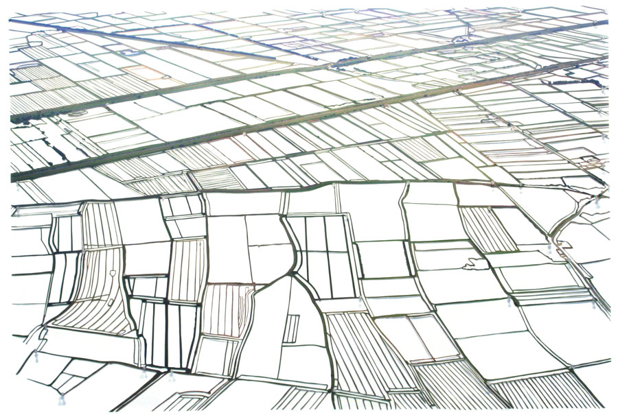
Green Dyke Detail © Alan Cook, 2006, courtesy FVU.
Hundred Foot Washes (2005) Cut-out, laminated, Lamda photo print 180cm x 120cm
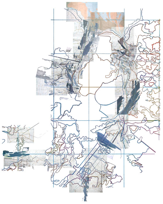
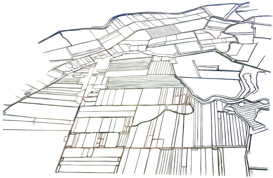
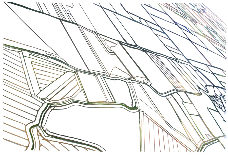
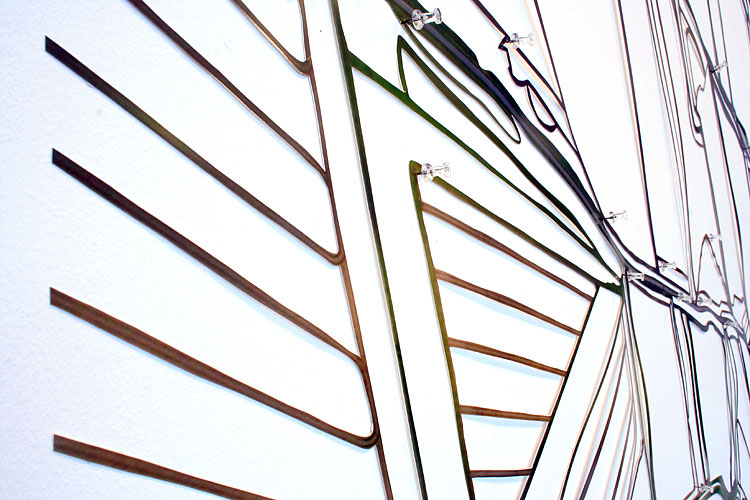
Fen Cuts (Map) (2005) Photo- and cartographic montage.
Map for film Cut Drains, Charts, Creeks and Cuts
FEN CUTS
Drains, Cables, and Cuts is a photographic/video installation by Annabel Howland consisting of Howland’s signature cut-out images, a series of related landscape photographs and (a first for the artist) a digitally animated film.
Commissioned by Film and Video Umbrella and Norwich School of Art and Design, it is a work on the theme of landscape and technological innovation produced as part of Silicon Fen, a three-year programme of artists’ projects supported by Arts Council England East. This staging of Drains, Cables, and Cuts at King's Lynn Arts Centre, (14 January to 25 February, 2006) received additional support from the Mondriaan Foundation and the Fonds voor BKVB.
The focus of the project is the landscape of the East Anglian Fenland, rendered as a complex network of lines through the lens of a camera or a series of highly tactile cartographic abstractions. From the ground, the flatness of the Fens makes everything appear in relation to a vanishing point or an ever-present horizon line. From the air, however, this unique landscape reveals itself as an intricate, evocative space of overlapping lines and contours. The paths of old watercourses visible in the soil diverge from their contemporary counterparts or converge with other features, such as physical or administrative boundaries.
For her digital animation, Howland cut out aerial photographs of the Fens so that only watercourses, clouds and the shadows of clouds remain. These fragile images were then matched to their corresponding locations on a photographed map. The map had also been extensively edited so that only numbers remain and words and names that relate to water, light or measurements: Hundred Foot Washes and Twenty Foot Drain; Bridge, Dike, Lode and Leam; Gowt and Gote and Fifties and Forty; Marsh, Mere, Moor, Cut, River, Outfall. All this was further overlaid with brightly coloured contours derived from a soil chart of the area. These composite images were then animated into a 3D ‘fly-through’ along key Fenland waterways, down adjoining cuts and creeks, beginning and ending in The Wash.
Alongside this animation are two series of photographs. One, photographed from the ground, draws our attention to the lowness of the land, the line of the horizon marking the limit of what we can see or know. Stripped of the other features of the landscape, the intersecting lines (roads, tracks, railways, waterways, boundaries) in the large cut-out photographs come to occupy and define space almost architecturally. Oscillating between object and image, these works suggest an action that continues beyond their edges.